Navigating the seas has been a challenge since the first ships sailed around 3000 BC. Ptolemy described a longitudinal system in 150 BC, the first compass was used to estimate bearings in the 11th century, and the Jacob’s staff allowed sailors to estimate the height of celestial bodies above the horizon. The sextant, developed in 1730, and finally the chronometer (1759) gave mariners a method for refined navigation.
The sextant is still in use today and may gain importance in times of GPS jamming. The master class is astronavigation — fixing your position by observation of stars and planets. There are about a dozen stars used for celestial navigation, selected for brightness and distribution across the sky. These are the stars a navigator learns to identify and observe with a sextant.
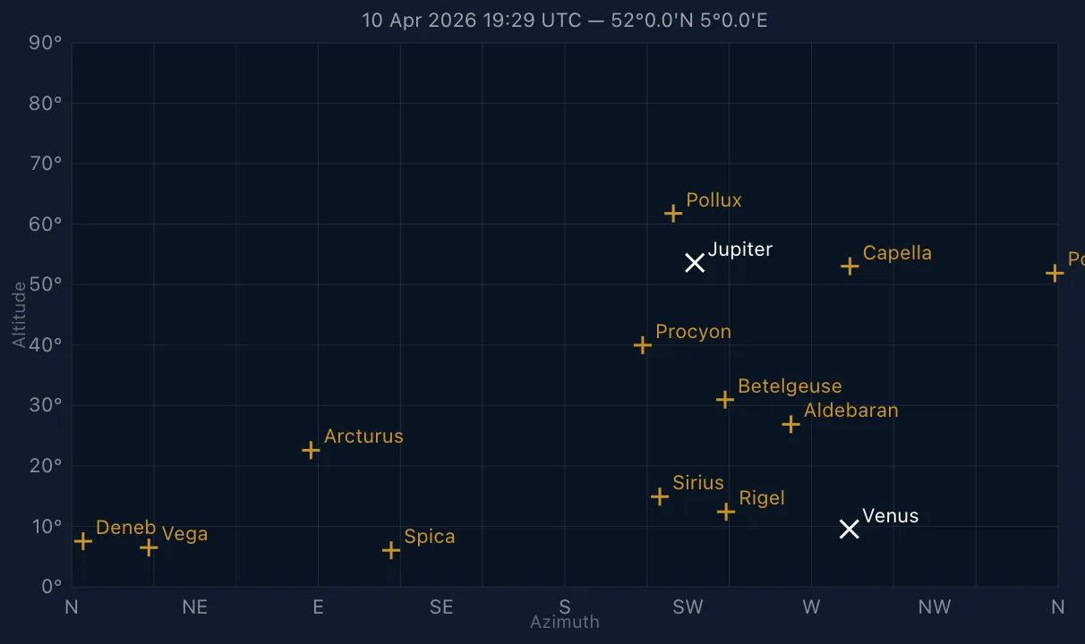
I built a planning tool that shows which of these stars are above the horizon at a chosen time and position. The chart plots azimuth along the horizontal axis — compass bearing from North through East — and altitude on the vertical — degrees above the horizon. Stars are marked with + in gold, planets with × in white.
The app lives at sailorslog.io/astronav/.
The navigation stars
The chart includes Sirius, Canopus, Arcturus, Rigel, Procyon, Deneb, Vega, Altair, Spica, Capella, Pollux, Aldebaran, Polaris, and Betelgeuse. These fourteen cover the full range of right ascension and declination, ensuring that several are always visible from any latitude at any time of year.
The planets
Four planets are also tracked: Venus, Mars, Jupiter, and Saturn. When above the horizon, planets are excellent sextant targets — bright, unambiguous, and listed in every nautical almanac.
Planning a sight
The best time to take star sights is during nautical twilight — roughly an hour after sunset, when the horizon is still visible but stars have appeared. The app has a “Set to twilight” button that computes this window automatically for your date and location. You can enter coordinates manually or use your device’s GPS.
Below the chart, info cards show sun and moon data: rise and set times, the sun’s meridian passage and declination, and the moon’s phase and illumination. Useful context when planning an evening of sights.
From chart to fix
Once you know which stars are up, the next step is reducing your sextant observations to a position fix. That’s where Intercept comes in — a companion tool that takes your sight data and computes intercept values and azimuth lines.
The stack
- Astro for the static shell and routing
- TypeScript for all sight-reduction logic
- Canvas API for the sky chart rendering
- astronomy-engine for celestial position calculations